 |
| Get a Glimpse of the Big Picture |
“Where do I live? Can you show me?”
Map activities give young children a glimpse into the big picture of the world and where they live. It introduces maps and how to use them to find areas we find interesting or want to visit.
You’ll need Google Maps Apps or paper maps from the local Chamber of Commerce or tourist center.
You’ll need Google Maps Apps or paper maps from the local Chamber of Commerce or tourist center.
Using maps of your local area locate children’s streets and some familiar sites like the library, grocery stores, parks, and museums.
Explain to children that that they live on this street, in their city. The next time they travel by car or walk to the park, show them their address number on their house, follow the map and route. You can program Google Maps to help you walk the route. Just follow the dots. You can also compare the paper map with the Google Maps App.
 |
| Google Maps or Any Maps Show WHERE |
Another day bring out the state map or App and show children their area on that map. Using the state map, look for some sites they may have visited like lakes, rivers, and homes of relatives. Children can help follow the paper map or App travel route on the next trip. They’ll have fun listening to the phone voice giving directions.
Families can practice memorizing their street address, city, and state and talk about using Google Maps and finding different views. The bird’s eye view is really fun for kids. They can zoom in closer and closer on
the App until they can see their roof top and even cars in the driveway.
What does their favorite park look like from high above the trees? How does Google make these maps? Ask Google or You Tube the question. There are great map explanations on line.
Using a US map or Google Earth App point out a few places children may be curious about like Disney World, Washington D.C., mountain areas, rivers, and Great Lakes. They can go to these sites and zoom in.
 |
| Get a Bird's Eye View |
Libraries have globes to show children that the earth is not flat like a map. Cheap blow up beach ball globes are also available on-line.
Show children where Santa lives and the route he must take to their house. The North Pole can help children hold the globe correctly to find and name continents and countries.
Interesting geography reading books for young children include David Scillian’s books, “P is for Passport: A World Alphabet” and “A is for America: An American Alphabet”; alphabet books for every state and for some countries.
The next time you’re playing in the sandbox with the kids make a map of geographic features like mountains, rivers. islands, and peninsulas. For more see grandparentsteachtoo.blogspot.
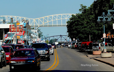
Photo: Fran Darling, fdarling fotos
Maps: Google
Photo: Fran Darling, fdarling fotos
Maps: Google
No comments:
Post a Comment